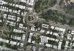
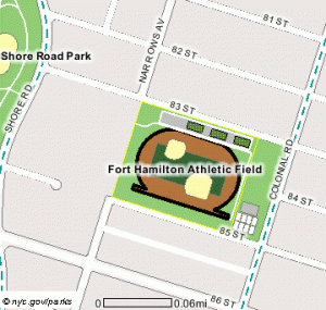
Field Locations
Prospect Park • Parade Grounds • Dewey Field / Sunset • DiMattina • Dust Bowl • Bensonhurst • Narrows • Van Voorhees • Shore Road • Red Hook • Holy Name Our Lady’s Field • Ft. Hamilton High • Parkville • Dyker Park
PROSPECT PARK:
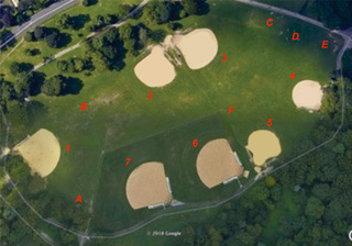
Directions: Go in the 9th Street entrance to Prospect Park on Prospect Park West. Walk straight east across the inner roadway, down onto the fields. Field 4 is straight ahead—see the second map below which indicates the locations of all the fields by division. You can also enter the Park on Prospect Park SW between 10th & 11th Avenue.
Closest subway stations: F train – 7th Ave & 9th Street Station (7th Avenue stop) or 15th Street Station (15th Street stop)
PARADE GROUNDS:
Location: On the corner of Parkside Avenue and Parade Place. Field 6 is the corner field; Field 5 is inside the Park and is entered from Parade Place.
Closest subway station: Q Train to Parkside at Ocean Avenue (walk West along Parkside) or Q Train to Church at East 18th (Exit on Caton Avenue, walk East on Caton Avenue, then North on Parade Place). 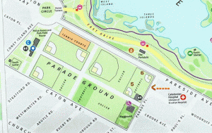
DEWEY/SUNSET PARK:
Location: On the east side of 3rd Avenue between 40th and 41st street.
Closest subway station: N or R trains – 45th Street & 4th Avenue.
DiMattina
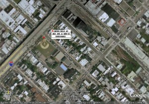
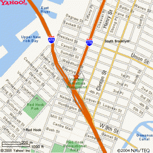
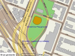
Location: Hicks Street at Rapelye Street
Directions: Take 9th Street to Hamilton Avenue. Turn Right on Hamilton Ave. Turn Right on Hicks Street (right after the entrance ramp to the BQE). The field is immediately on the right.
Closest Subway: Carroll Street F and G trains
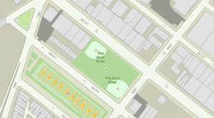
Dust Bowl
Location:
Dust Bowl 1 (65th Street between 7th-8th Ave – Western-most field)
Dust Bowl 2 (corner of 65th Street & 8th Ave)
Directions: Take 6th Ave Exit (Exit 20) off 287 West heading towards Verrazano Bridge.
Closest Subway: 8th Avenue N Train
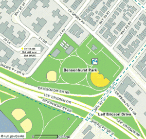
Bensonhurst
Location: Cropsey at 21st Ave
Directions: Take Prospect Expressway/RT-27 East towards Ocean Parkway. Continue on Ocean Parkway. Turn Right on Bay Parkway. Turn Right on Cropsey Ave to 21st Avenue.
Closest Subway: D and M trains to Bay Parkway, walk to Cropsey Avenue.
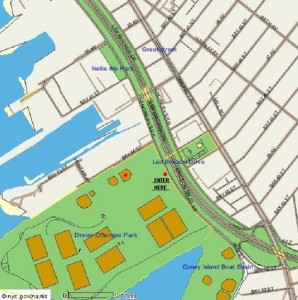
Narrows Fields 1 and 2
By Car: Take the Belt Parkway East, past the Verrazano Bridge. Take the Bay Parkway exit (past the Nellie Bly Kiddie Amusement Park), which puts you on Shore Parkway ˆ the service road. Follow Shore Parkway east straight, past 26th Avenue and past the Yacht Club. The fields will be on the right about 100 yards past Bay 44th Street. In the map, the larger field on the right is Field 1; the smaller field on the left is Field 2.
By Subway: Take the D train to the Bay Parkway station
By Bus: Take the #6 bus to 26th Avenue.
Parkville Field:
By Car:
Between 65th & 66th Streets between 8th-9th Avenues
Parkville
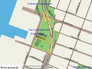
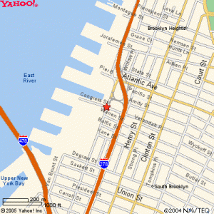
VanVoorhees
By Car: Take 9th Street to Hamilton Avenue. Turn Right on Hamilton Avenue, Turn Right on Columbia Street to Congress Street.
Closest Subway: Carroll Street F and G trains.
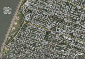
Shore Road
By Car:
1. Take I-278 West /BROOKLYN QUEENS EXPY/GOWANUS EXPY via the ramp on the LEFT.
2. Keep LEFT to take BELT PKWY East via EXIT 22. (0.87 miles)
3. Take EXIT 1 toward 65-67 STS. (0.21 miles)
4. Turn SLIGHT LEFT onto SHORE ROAD DR.. (0.04 miles)
5. Turn SLIGHT RIGHT onto ramp. (0.10 miles)
6. Turn RIGHT onto RIDGE BLVD. (0.23 miles)
7. Turn RIGHT onto BAY RIDGE AVE/69TH ST. (0.41 miles)
8. Turn LEFT onto SHORE RD. (0.55 miles)
9. End at Shore Rd & 78th St
Alt Car Route
1. South on 4th Ave. to Bay Ridge Pkwy (after 74th St)
2.Turn Left onto Bay Ridge Pkwy and go straight to Shore Road.
3. Field entrance is on Shore Road & 79th St.
By Train
1. R train to 77th Street stop
2. Walk west along 77th St. to Shore Road
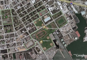
Red Hook Recreation Area Fields
Red Hook 5 (Bay and Henry Street)
Red Hook 6 (Lorraine & Henry Streets)
Red Hook 7 (Hicks and Lorraine Streets)
Red Hook 8 (Hicks and Bay Streets)
Directions:Directions to Red Hook Field:
BY CAR: Take any street that connects you with Court St.(Court St. is a one way street)
Proceed south on Court St. to Bay St.
Turn Right onto Bay St. & proceed four (4) blocks to Columbia St.
Turn Left onto Columbia St. Proceed approximately two (2) short blocks.
Fields are on your Left.
BY TRAIN:Take F or G line to Smith / 9th St. Station
Transfer to B77 bus line & get off at the corner of Lorraine St. & Columbia St.
Walk South on Columbia St. approximately 4 Blocks.
Fields are on your left.
Holy Name-Our Lady’s Field
Entrance to the field is on 16th Street between Prospect Park West and 10th Avenue.
The closest train station is F train 15th Street Station. The buses are B69, B75 and B68.
Ft. Hamilton High
Directions: Subway
Take the R train heading to Bay Ridge
Get off at 86 Street station
Exit near intersection of 86th St and 4th Ave
Go North on 4th Ave towards 85th St
Turn left on 84th St to Colonial Road.
Car
4TH AVE SOUTH
Turn RIGHT on BAY RIDGE PKY
Turn LEFT on COLONIAL RD
Arrive at COLONIAL RD AT 84TH ST, BROOKLYN.
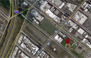
Dyker Park Field 4:
Location: 14th Ave near 86th street across from 8635 14th Ave, Brooklyn, NY 11228
Directions: By Car: By Car: Take 278 toward Staten Island. Get off at 86th Street exit. Go east on 86th Street. Dyker Park fields are on the corner of 86th Street and 14th Avenue. The entrance to the field is on 14th Avenue. Closest Subway – D train 18th Avenue at 85th Street
Closest subway stations: D train 18th Avenue at 85th Street

